FAQs


-
Aerial photography captures images of the Earth's surface from above, mainly for visual or artistic purposes. In contrast, photogrammetry uses these images for precise measurements, data extraction, and for the creation of detailed 2D or 3D maps and models.
-
No. We are drone pilots and photographers who use our drones and DSLR cameras to capture images of land surfaces and other structures, such as buildings, bridges, towers and other items with our drones. We then use commercially available computer software to stitch together the images to create very accurate 2D orthomosaic maps and 3D models. We are not licensed surveyors, nor do we claim to be. Our maps and models are highly accurate, but they are not recognized by the State of Texas as a professional survey work product. However, we do understand that a licensed survey professional may sign-off on our work. Therefore, our maps and models should be used as reference material only. Stakeholders should understand that our maps and models may only be used to help them track construction progress or to evaluate buildings, infrastructure or land surfaces and not as an authoritative public record. We are not a licensed survey company, nor do we employ any licensed, professional surveyors.
Furthermore, we do not engage in any of the following professional survey tasks:
1) Locating, relocating, establishing, laying out, or retracing any property line, easement, or boundary of any tract of land.
2) Locating, relocating, establishing, or laying out the alignment or elevation of any of the fixed works embraced within the practice of professional engineering.
3) Making any survey for the subdivision of any tract of land, including the topography, alignment and grades of streets and incidental drainage within the subdivision, and the preparation and perpetuation of maps, record plats, field note records, and property descriptions that represent these surveys.
4) Determining, by the use of the principles of land surveying, the position for any survey monument or reference point, or setting, resetting, or replacing any survey monument or reference point.
5) Determining the configuration or contour of the earth’s surface by measuring lines and angles and applying the principles of mathematics or photogrammetry.
6) Providing geodetic surveying which includes surveying for determination of the size and shape of the earth both horizontally and vertically and the precise positioning of points on the earth utilizing angular and linear measurements through spatially oriented spherical geometry; and
7) Creating, preparing, or modifying electronic or computerized data, including land information systems and geographic information systems relative to the performance of the practice of land surveying.
-
Drone mapping uses drones to take aerial photos and gather data for mapping. It is a cost-effective and efficient way to get accurate location information compared to traditional methods.
-
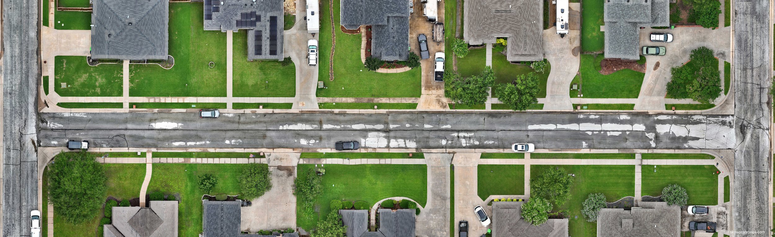
An orthomosaic map is a precise aerial image that offers a straight top-down view of an area, without distortions or perspective issues. It's often referred to as an orthoimage, orthophotograph, or simply an orthomosaic.
-
The main industries that use orthomosaic maps are real estate, law enforcement and emergency response, agriculture, construction, environmental conservation and urban planning.
-
An orthomosaic map is a true-to-scale, distortion-free representation of an area, allowing for accurate distance measurements. RTK (Real Time Kinematics) corrects satellite navigation errors caused by factors like weather, enabling centimeter-level accuracy. RTK data can come from a base station or an NTRIP network, which utilizes internet-linked virtual base stations. Without internet, a self-supporting base station like the D-RTK 3 can be used, along with a DJI Matrice 4E, for example, to correct satellite data and create an orthorectified map with millimeter-level accuracy.
-
Photogrammetry uses drone images to make 3D models and maps. It's best in bright conditions where fine details are needed. This method is cheaper than LiDAR, which uses lasers to scan and create detailed 3D models. Drone photogrammetry is commonly used for budget-friendly projects.
-
Drone mapping control points are fixed locations on the ground with known coordinates, often marked by vertical poles placed on a mat or target. These points help improve accuracy in drone mapping, a process called photogrammetry.
A minimum of three GCPs should be set up inside the perimeter of the area being mapped, not along the boundary.
-
Most stakeholders use drone maps to generate progress reports for mining, construction, and building projects, helping those who can't visit the site. Others take photos at different times during the project to clarify issues or budget questions that may come up. Drone maps can also be combined with plans to verify the development area's location. Additionally, they are used to assess crop health and identify spots needing treatment for pests.
3D models might also be used to preserve historic sites prior to renovation or removal of that site for new construction.
-
Drone mapping is a faster, safer, and more cost-effective way to obtain high-resolution spatial data than traditional surveying. It enables large-scale mapping, delivers highly accurate data, and is non-intrusive, making it suitable for sensitive environments.
-
These are the main types of drone mapping used in different industries:
2D orthomosaic maps: High-quality, location-based images made by combining several aerial photos. Used in construction, land surveying, and agriculture.
3D models: Detailed 3D views of buildings or landscapes, useful in construction and mining.
Digital elevation models (DEMs): Terrain representations needed for planning infrastructure and assessing flood risks.
Thermal mapping: Uses infrared cameras to measure temperature, helpful for utilities in finding faults or heat loss.
-
The curtilage of a house or dwelling is the land immediately surrounding it, including any closely associated buildings and structures, but excluding any open fields beyond it.